 Go back to Asian Art News
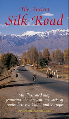
ILLUSTRATED MAP OF THE SILK ROAD BY JONATHAN TUCKER
Silk Road Map
Featuring the ancient network of routes from China to Europe
By Jonathan Tucker
Photography: Antonia Tozer
Publisher: Odyssey Publications,Hong Kong
Price: £8.99
Made famous in the West by the Venetian adventurer Marco Polo, the ancient Silk Road spanned one-quarter of the circumference of the Earth. An intricate network of trading routes, in its heyday it stretched from Luoyang and Xi’an in China, through Central Asia to Istanbul and Rome, perhaps the first example of the globalisation of trade. This is a double sided, illustrated, folded map/information sheet of the Silk Road routes across Central Asia, the Middle East, Asia Minor and China. There is one large scale overview map of land and sea routes plus three more detailed regional maps. The ‘map’ includes comprehensive notes with cultural and historical information on key places and people.
+ One large overview map and three detailed regional maps + Comprehensive notes with cultural and historical information on key places and people + Special essay on Afghanistan’s geographical and historical significance to Silk Road trade + 33 superb colour photographs + Easy-to-use fold-out format